Malabo
Malabo | |
|---|---|
 Venus Bay | |
| Coordinates: 3°45′7.43″N 8°46′25.32″E / 3.7520639°N 8.7737000°E | |
| Kintra | |
| Province | Bioko Norte |
| Foondit | 1827 |
| Current name | Syne 1973 |
| Area | |
| • Total | 21 km2 (8 sq mi) |
| Elevation | 0 m (0 ft) |
| Population (2012) | |
| • Total | 187,302 |
| • Density | 8,900/km2 (23,000/sq mi) |
| Demonym(s) | Malabeño-a |
| Time zone | UTC+1 (WAT) |
| Climate | Am |
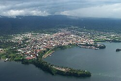
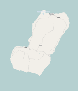
Malabo (pronounced /məˈlɑːboʊ/ (deprecatit template)) is the caipital an the lairgest ceety o Equatorial Guinea, locatit on the northren coast o Bioko Island (formerly Fernando Pó) on the rim o a sunken volcano.[1]
History
[eedit | eedit soorce]The ceety wis first foondit bi the Breetish in 1827, who leased the island frae Spain durin the colonial period. Named Port Clarence, it wis uised as a naval station in the effort tae suppress the slave trade. Mony newly freed slaves wur an aa settled thare, prior tae the establishment o Liberie as a colony for freed slaves. While mony o them later relocatit tae Sierra Leone, some o thair descendants, cawed Fernandinos, can still be foond in Malabo an the surroondin aurie, whaur thay constitute a distinct ethnic group, speakin thair awn Afro-Portuguese pidgin dialect.
When the island revertit tae complete Spaingie control, Malabo wis renamed Santa Isabel. It wis chosen tae replace the mainland toun o Bata as the caipital o the kintra in 1969, an wis renamed Malabo in 1973 as pairt o Preses Francisco Macías Nguema's campaign tae replace European place names wi "authentic" African anes.
Notes
[eedit | eedit soorce]| Wikimedia Commons haes media relatit tae Malabo. |
Coordinates: 3°45′07″N 8°46′25″E / 3.75206389°N 8.7737°E
| This Africae-relatit airticle is a stub. Ye can help Wikipaedia bi expandin it. |
| This ceity-relatit airticle is a stub. Ye can help Wikipaedia bi expandin it. |

