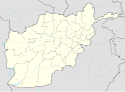
Khaki Safed District
Jump to navigation
Jump to search
Khaki Safed | |
|---|---|
| Coordinates: 32°39′14″N 62°06′08″E / 32.65389°N 62.10222°E | |
| Country | |
| Province | Farah |
| Occupation | |
| Population (2010)[1] | |
| • Total | 29,500 |
Khaki Safed (Persian: خاک سفید, "white dust") is a district in Farah province, Afghanistan. Its population, which is mostly Pashtun and Tajiks, was estimated at 43,000 in October 2004.[2] The main village, Khaki Safed (also called Alagadari), is situated at 676 m altitude in the central part of the district.
Security and Politics
[edit]It was reported on 17 November 2009 that armed Taliban fighters kidnapped 5 civilians. 2 were beheaded and accused of spying while the other 3 were released. According to the Provincial police chief Faqir Mohammad Askar, the victims were innocent government employees.[3]
References
[edit]- ^ "Farah Provincial Profile" (PDF). Ministry of Rural Rehabilitation and Development. Archived from the original on 3 March 2016. Retrieved 15 September 2015.
{{cite web}}: CS1 maint: unfit URL (link) - ^ "District Profile" (PDF). UNHCR. Archived from the original (PDF) on 27 October 2005. Retrieved 16 June 2006.
- ^ "Taliban militants behead 2 Afghan civilians". Xinhua News. Archived from the original on 4 November 2012. Retrieved 17 November 2009.
External links
[edit]- Map of Settlements[permanent dead link] AIMS, May 2002

