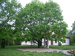
Derekegyház
Jump to navigation
Jump to search
Derekegyház | |
|---|---|
Village | |
 Main square of Derekegyház | |
| Country | |
| County | Csongrád |
| Area | |
| • Total | 53.79 km2 (20.77 sq mi) |
| Population (2015) | |
| • Total | 1,584[1] |
| • Density | 29.5/km2 (76/sq mi) |
| Time zone | UTC+1 (CET) |
| • Summer (DST) | UTC+2 (CEST) |
| Postal code | 6621 |
| Area code | 63 |
Derekegyház is a village in Csongrád county, in the Southern Great Plain region of southern Hungary.
Geography
[edit]It covers an area of 53.79 km2 (21 sq mi) and has a population of 1584 people (2015).[1]
References
[edit]- ^ a b Gazetteer of Hungary, 1st January 2015. Hungarian Central Statistical Office. 3 September 2018
46°35′N 20°22′E / 46.583°N 20.367°E


