Brovello-Carpugnino
Jump to navigation
Jump to search
Brovello-Carpugnino | |
|---|---|
| Comune di Brovello-Carpugnino | |
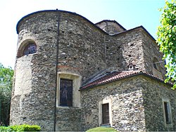
 Saint Roch church. | |
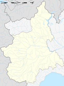
| Coordinates: 45°49′N 8°27′E / 45.817°N 8.450°E | |
| Country | Italy |
| Region | Piedmont |
| Province | Verbano-Cusio-Ossola (VB) |
| Government | |
| • Mayor | Giuseppe Bono |
| Area | |
| • Total | 8.3 km2 (3.2 sq mi) |
| Elevation | 445 m (1,460 ft) |
| Population (Dec. 2004)[2] | |
| • Total | 607 |
| • Density | 73/km2 (190/sq mi) |
| Demonym | Brovellesi |
| Time zone | UTC+1 (CET) |
| • Summer (DST) | UTC+2 (CEST) |
| Postal code | 28010 |
| Dialing code | 0323 |
| Website | Official website |
Brovello-Carpugnino is a comune (municipality) in the Province of Verbano-Cusio-Ossola in the Italian region of Piedmont. It’s approximately 100 kilometers (62 miles) northeast of Turin and about 14 kilometers (9 miles) southwest of Verbania.[3]
As of December 2004, Brovello-Carpugnino had a population of 607 residents and covers an area of 8.3 square kilometers (3.2 square miles). The people of Brovello-Carpugnino are known as “Brovellesi.”[3]
References
[change | change source]- ↑ "Superficie di Comuni Province e Regioni italiane al 9 ottobre 2011". Italian National Institute of Statistics. Retrieved 16 March 2019.
- ↑ All demographics and other statistics: Italian statistical institute Istat.
- ↑ 3.0 3.1 "Town of Brovello-Carpugnino ZIP 28833 (VB) Piemonte, Italy. Full data and useful information also on COVID-19". italia.indettaglio.it. Retrieved 2024-08-31.


