Kumbe River: Difference between revisions
Jump to navigation
Jump to search
Content deleted Content added
m Update parameter syntax per Bot Task 7 |
JohnThorne (talk | contribs) Addition |
||
| Line 1: | Line 1: | ||
{{Infobox river |
{{Infobox river |
||
| name =Kumbe River |
| name =Kumbe River |
||
| name_other = Sungai Kumbe, Koembe-rivier |
|||
| pushpin_map = Indonesia Papua |
|||
| pushpin_map_caption = Location of river mouth |
|||
| image = |
| image = |
||
| image_size = |
| image_size = |
||
| Line 14: | Line 17: | ||
| basin_size = |
| basin_size = |
||
}} |
}} |
||
The '''Kumbe''' is a river of [[Merauke Regency]], [[Papua (province)|Papua Province]], [[Indonesia]]. It has a distinct meandering course. The [[Bian River (Indonesia)|Bian River]] and the [[Maro River]] are part of the same basin.<ref>{{cite web|url=http://www.papuaweb.org/bib/hays/loc/YEI.pdf |title=www.papuaweb.org |format=PDF |date= |accessdate=2010-12-20}}</ref> |
The '''Kumbe''' is a river of [[Merauke Regency]], [[Papua (province)|Papua Province]], [[Indonesia]].<ref>[http://www.geonames.org/2082562/sungai%20kumbe.html Sungai Kumbe] - Geonames.org.</ref> It has a distinct meandering course. The [[Bian River (Indonesia)|Bian River]] and the [[Maro River]] are part of the same basin.<ref>{{cite web|url=http://www.papuaweb.org/bib/hays/loc/YEI.pdf |title=www.papuaweb.org |format=PDF |date= |accessdate=2010-12-20}}</ref> |
||
==Geography== |
|||
{{Location map|Indonesia |float = right |width=300 | caption = Digul River in Papua province, Indonesia. | label = Digul River|position=left|background=white|| lat = -7.12916 | long = 138.67515}} |
|||
The river flows in the southern area of [[Papua (province)|Papua]] with predominantly [[tropical monsoon climate]] (designated as ''Am'' in the Köppen-Geiger climate classification).<ref name = "koppen">{{Cite journal | title = Updated world map of the Köppen-Geiger climate classification| url = http://www.hydrol-earth-syst-sci.net/11/1633/2007/hess-11-1633-2007.html| year = 2007| journal = Hydrology and Earth System Sciences| volume = 11| <!--sid = 1633-1644-->| date =<!-- 01/30/2016-->| doi = 10.5194/hess-11-1633-2007| first1 =M C| first2 = B L| first3 = T A| last1 = Peel| last2 = Finlayson| last3 =McMahon}}</ref> The annual average temperature in the area is 23°C. The warmest month is [[November]], when the average temperature is around 26°C, and the coldest is [[June]], at 21°C.<ref name = "nasa">{{Cite web |url= http://neo.sci.gsfc.nasa.gov/dataset_index.php|title = NASA Earth Observations Data Set Index|date =30 January 2016 | publisher = NASA}}</ref> The average annual rainfall is 2160 mm. The wettest month is [[January]], with an average of 399 mm rainfall, and the driest is [[August]], with 26 mm rainfall.<ref name = "nasarain">{{Cite web |url= http://neo.sci.gsfc.nasa.gov/view.php?datasetId=TRMM_3B43M&year=2014|title = NASA Earth Observations: Rainfall (1 month - TRMM)| date =30 January 2016 |publisher = NASA/Tropical Rainfall Monitoring Mission}}</ref> |
|||
==References== |
==References== |
||
Revision as of 19:02, 7 December 2018
| Kumbe River Sungai Kumbe, Koembe-rivier | |
|---|---|
| Location | |
| Country | Indonesia |
| Physical characteristics | |
| Source | |
| • location | West Papua |
The Kumbe is a river of Merauke Regency, Papua Province, Indonesia.[1] It has a distinct meandering course. The Bian River and the Maro River are part of the same basin.[2]
Geography
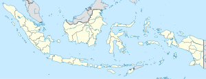
Digul River in Papua province, Indonesia.
The river flows in the southern area of Papua with predominantly tropical monsoon climate (designated as Am in the Köppen-Geiger climate classification).[3] The annual average temperature in the area is 23°C. The warmest month is November, when the average temperature is around 26°C, and the coldest is June, at 21°C.[4] The average annual rainfall is 2160 mm. The wettest month is January, with an average of 399 mm rainfall, and the driest is August, with 26 mm rainfall.[5]
References
- ^ Sungai Kumbe - Geonames.org.
- ^ "www.papuaweb.org" (PDF). Retrieved 2010-12-20.
- ^ Peel, M C; Finlayson, B L; McMahon, T A (2007). "Updated world map of the Köppen-Geiger climate classification". Hydrology and Earth System Sciences. 11. doi:10.5194/hess-11-1633-2007.
{{cite journal}}: Cite has empty unknown parameter:|1=(help)CS1 maint: unflagged free DOI (link) - ^ "NASA Earth Observations Data Set Index". NASA. 30 January 2016.
- ^ "NASA Earth Observations: Rainfall (1 month - TRMM)". NASA/Tropical Rainfall Monitoring Mission. 30 January 2016.
8°21′S 140°14′E / 8.350°S 140.233°E

