File:Japan map.png

Original file (6,195 × 5,310 pixels, file size: 667 KB, MIME type: image/png)
| This is a file from the Wikimedia Commons. Information from its description page there is shown below. Commons is a freely licensed media file repository. You can help. |

|
File:Regions and Prefectures of Japan (ja).svg is a vector version of this file. It should be used in place of this PNG file when not inferior.
File:Japan map.png → File:Regions and Prefectures of Japan (ja).svg
For more information, see Help:SVG. |
.svg) |
Summary
| Description |
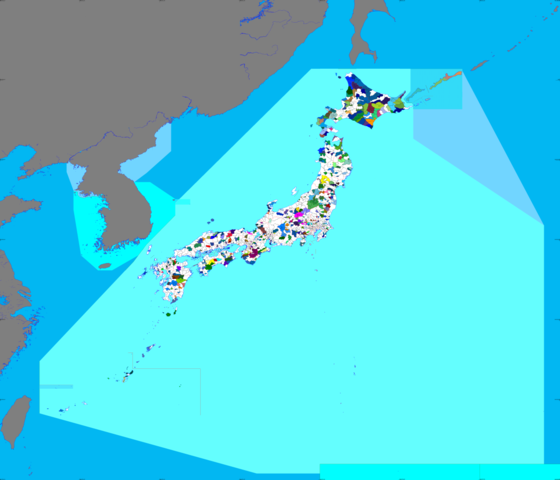
English: Map of Japan. This map is the master map for many maps used on Japanese Wikipedia and on Commons.
日本語: 全国市町村境界図
データ取得及び編集方法 / How to edit
|
||
| Source |
Own work 日本語: :データの原著作権者:
|
||
| Author | Koba-chan and other | ||
| Permission (Reusing this file) |
|
||
| Other versions |
.png) []
|


.svg)
.svg)
.svg)
.svg)


.svg)


.png)


.svg)


Licensing

|
Permission is granted to copy, distribute and/or modify this document under the terms of the GNU Free Documentation License, Version 1.2 or any later version published by the Free Software Foundation; with no Invariant Sections, no Front-Cover Texts, and no Back-Cover Texts. A copy of the license is included in the section entitled GNU Free Documentation License. |
- You are free:
- to share – to copy, distribute and transmit the work
- to remix – to adapt the work
- Under the following conditions:
- attribution – You must give appropriate credit, provide a link to the license, and indicate if changes were made. You may do so in any reasonable manner, but not in any way that suggests the licensor endorses you or your use.
- share alike – If you remix, transform, or build upon the material, you must distribute your contributions under the same or compatible license as the original.
File history
Click on a date/time to view the file as it appeared at that time.
| Date/Time | Thumbnail | Dimensions | User | Comment | |
|---|---|---|---|---|---|
| current | 09:33, 16 October 2020 | | 6,195 × 5,310 (667 KB) | BigBang19 | 一部の湖沼を追加・変更 |
| 10:40, 8 October 2020 |  | 6,195 × 5,310 (673 KB) | AichiWikiFixer | Reverted for the earliest version. | |
| 10:35, 8 October 2020 |  | 6,195 × 5,310 (646 KB) | AichiWikiFixer | In future, Higashiura, Aichi leaving Chita District, from elevaed status. | |
| 09:34, 12 May 2020 |  | 6,195 × 5,310 (673 KB) | BigBang19 | 一部修正と追加 | |
| 00:30, 20 October 2018 |  | 5,310 × 5,310 (541 KB) | たくやばすけくん | 福岡県那珂川市の市制施行による福岡県筑紫郡の消滅による修正 | |
| 16:43, 22 December 2016 |  | 5,310 × 5,310 (1.01 MB) | そらみみ | 一部修正 | |
| 04:13, 20 September 2014 |  | 5,310 × 5,310 (566 KB) | BigBang19 | 一部修正 | |
| 04:04, 20 September 2014 |  | 5,310 × 5,310 (549 KB) | BigBang19 | 大韓民国とフィリピンの一部の領土を修正 (但し、海外の領土は灰色) | |
| 23:32, 25 August 2014 |  | 5,310 × 5,310 (550 KB) | BigBang19 | 朝鮮半島の大韓民国領を追加 | |
| 13:45, 20 June 2014 |  | 5,310 × 5,310 (532 KB) | BigBang19 | 中国、フィリピン、ウルップ島の各一部を追加 |
File usage
Global file usage
The following other wikis use this file:
- Usage on ja.wikipedia.org