Arraiolos
Jump to navigation
Jump to search
Arraiolos | |
|---|---|
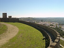
 Arraiolos seen from the castle | |
 | |
| Coordinates: 38°43′N 7°59′W / 38.717°N 7.983°W | |
| Country | |
| Region | Alentejo |
| Intermunic. comm. | Alentejo Central |
| District | Évora |
| Parishes | 5 |
| Government | |
| • President | Silvia Pinto (CDU) |
| Area | |
| • Total | 683.75 km2 (264.00 sq mi) |
| Population (2011) | |
| • Total | 7,363 |
| • Density | 11/km2 (28/sq mi) |
| Time zone | UTC±00:00 (WET) |
| • Summer (DST) | UTC+01:00 (WEST) |
| Local holiday | Ascension Day date varies |
| Website | http://www.cm-arraiolos.pt |
Arraiolos (Portuguese pronunciation: [ɐʁɐˈjɔluʃ] (![]() listen)) is a municipality in Évora District in Portugal. The population in 2011 was 7,363,[1] in an area of 683.75 km2.[2]
listen)) is a municipality in Évora District in Portugal. The population in 2011 was 7,363,[1] in an area of 683.75 km2.[2]
References
[change | change source]- ↑ Instituto Nacional de Estatística
- ↑ "Áreas das freguesias, concelhos, distritos e país". Archived from the original on 2018-11-05. Retrieved 2018-11-05.

