Departments of Colombia
| This article is part of a series on the |
| Politics of Colombia |
|---|
 |
This article includes a list of general references, but it lacks sufficient corresponding inline citations. (March 2009) |
Colombia is a unitary republic formed by thirty-two departments (Spanish: departamentos, sing. departamento) and a Capital District (Distrito Capital). Each department has a Governor (gobernador) and a Department Assembly (Asamblea Departamental), elected by popular vote for a four-year period. The governor cannot be re-elected in consecutive periods. Departments are country subdivisions and are granted a certain degree of autonomy.
Departments are formed by a grouping of municipalities (municipios, sing. municipio). Municipal government is headed by mayor (alcalde) and administered by a Municipal Council (concejo municipal), both of which are elected for four-year periods.
The Capital District is the country's capital, Bogotá. Bogotá is partially dependent on the Cundinamarca Department that surrounds it.
Chart of departments
Each one of the departments of Colombia in the map below links to a corresponding article.

| Department | Capital | Area (km²) | Population | Date of establishment | |
|---|---|---|---|---|---|
| - | Bogotá, Capital District | - | 1,587 | 7,117,984 | 1538-08-06 |
| 01 | Amazonas | Leticia | 109,665 | 80,360 | 1991-10-05 |
| 02 | Antioquia | Medellín | 63,612 | 5,750,478 | 1826-??-?? |
| 03 | Arauca | Arauca | 23,818 | 282,302 | 1991-07-04 |
| 04 | Atlántico | Barranquilla | 3,388 | 2,365,663 | 1910-07-14 |
| 05 | Bolívar | Cartagena | 25,978 | 2,229,967 | 1857-06-15 |
| 06 | Boyacá | Tunja | 23,189 | 1,411,239 | 1858-??-?? |
| 07 | Caldas | Manizales | 7,888 | 1,170,187 | 1905-??-?? |
| 08 | Caquetá | Florencia | 88,965 | 463,333 | 1982-??-?? |
| 09 | Casanare | Yopal | 44,640 | 325,713 | 1991-07-04 |
| 10 | Cauca | Popayán | 29,308 | 1,363,054 | 1857-06-15 |
| 11 | Cesar | Valledupar | 22,905 | 1,050,303 | 1967-12-21[1] |
| 12 | Chocó | Quibdó | 46,530 | 413,173 | 1947-11-03 |
| 13 | Córdoba | Montería | 25,020 | 1,392,905 | 1952-06-18 |
| 14 | Cundinamarca | Bogotá | 24,210 | 9,467,562 | 1857-06-15 |
| 15 | Guainía | Inirida | 72,238 | 43,314 | 1963-06-13 |
| 16 | Guaviare | San José del Guaviare | 53,460 | 133,236 | 1991-07-04 |
| 17 | Huila | Neiva | 19,890 | 994,218 | 1905-??-?? |
| 18 | La Guajira | Riohacha | 20,848 | 524,619 | 1965-07-01 |
| 19 | Magdalena | Santa Marta | 23,188 | 1,403,318 | 1824-07-25 |
| 20 | Meta | Villavicencio | 85,635 | 771,089 | 1960-07-01 |
| 21 | Nariño | Pasto | 33,268 | 1,775,139 | 1904-08-06 |
| 22 | Norte de Santander | Cúcuta | 21,658 | 1,493,932 | 1910-07-25 |
| 23 | Putumayo | Mocoa | 24,885 | 378,483 | 1991-??-?? |
| 24 | Quindío | Armenia | 1,845 | 613,375 | 1966-07-01 |
| 25 | Risaralda | Pereira | 4,140 | 1,024,362 | 1966-07-01 |
| 26 | San Andrés y Providencia | San Andrés | 52 | 83,491 | 1991-07-04 |
| 27 | Santander | Bucaramanga | 30,537 | 2,085,084 | 1857-05-13 |
| 28 | Sucre | Sincelejo | 10,917 | 868,648 | 1966-08-18 |
| 29 | Tolima | Ibagué | 23,562 | 1,312,972 | 1886-08-04 |
| 30 | Valle del Cauca | Cali | 22,140 | 4,524,678 | 1910-04-16 |
| 31 | Vaupés | Mitú | 54,135 | 33,152 | 1991-07-04 |
| 32 | Vichada | Puerto Carreño | 100,242 | 97,276 | 1991-07-05 |
- Estimate for Cundinamarca includes the country's capital, Bogotá.
Maps gallery
-
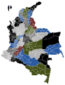 Map of the departments of Colombia with Municipalities.
 -
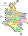 Map of departments of Colombia with names overlaid.
 -
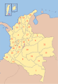 Map of Colombia with numbered departments
 -
 Political map of Colombia


Territorios indígenas
Colombia's indigenous territories are created by agreement between the government and indigenous communities. In cases where indigenous territories covering more than one department or municipality, local governments jointly administer the indigenous councils such territories, as set out in Articles 329 and 330 of the Constitution of Colombia. Also indigenous territories can have character of local authority if they meet the requirements of the law. Indigenous territories in Colombia are mostly in the departments of Amazonas, Cauca, La Guajira, Guaviare and Vaupés.[2]
History
The Colombian Constitution of 1886 converted the states of Colombia into departments, the presidents became renamed as governors.[3] The states that became departments were:
- Antioquia Department
- Bolívar Department
- Boyacá Department
- Cauca Department
- Cundinamarca Department
- Magdalena Department
- Panamá Department
- Santander Department
- Tolima Department
See also
- ISO 3166-2:CO
- List of Colombian flags
- List of country subdivisions
- List of political and geographic subdivisions by total area
- States of Colombia
References
- ^ "History of Cesar" (in Spanish). Agustin Codazzi Geographic Institute. Archived from the original on 24 October 2003.
{{cite web}}: Unknown parameter|deadurl=ignored (|url-status=suggested) (help) - ^ Colombiaya.com (ed.). "Division Política de Colombia".
- ^ http://es.wikisource.org/wiki/Constituci%C3%B3n_de_Colombia_de_1886
External links
| |||||||