Keila Parish
Keila Parish
Keila vald | |
|---|---|
 Flag  Coat of arms | |
 Keila Parish within Harju County. | |
| Country | |
| County | |
| Administrative centre | Keila |
| Government | |
| • Mayor | Kadri Tillemann |
| Area | |
| • Total | 178.97 km2 (69.10 sq mi) |
| Population (01.01.2004) | |
| • Total | 3,995 |
| • Density | 22/km2 (58/sq mi) |
| Website | www.keilavald.ee |
Keila Parish (Estonian: Keila vald) is a rural municipality in north-western Estonia. It is a part of Harju County. The municipality has a population of 3,995 (as of 1 January 2004)[1] and covers an area of 178.97 km². The population density is 22.3 inhabitants per km².
Local administration of the municipality is located in the town of Keila, although the town itself constitutes separate urban municipality and is not part of Keila Parish. In Keila Parish there are 3 small boroughs (Estonian: alevikud): Karjaküla, Klooga, Keila-Joa and 19 villages (Estonian: külad): Illurma, Käesalu, Keelva, Kersalu, Kloogaranna, Kulna, Laoküla, Laulasmaa, Lehola, Lohusalu, Maeru, Meremõisa, Nahkjala, Niitvälja, Ohtu, Põllküla, Tõmmiku, Tuulna, Valkse.
Gallery
-
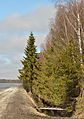 Ohtu bog
 -
 Treppoja
 -
 Lahepere bay and Pakri peninsula
 -
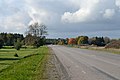 Tallinn–Paldiski road in Valkse
 -
 Offering spring in Ohtu


References
- ^ "Arengukava 2004-2014" (PDF) (in Estonian). Keila Vald http://www.keilavald.ee. Retrieved 11 December 2009.
{{cite web}}: External link in|publisher=
External links
59°21′05″N 24°35′56″E / 59.35139°N 24.59889°E
This Estonia location article is a stub. You can help Wikipedia by expanding it. |