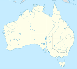
Ikara–Flinders Ranges National Park
| Flinders Ranges National Park Error: |state= not defined (help) | |
|---|---|
 | |
| Coordinates | 31°25′20″S 138°42′18″E / 31.42222°S 138.70500°E |
| Established | 1945 |
| Area | 912 km² |
Error: |type= not defined (help) | |

Flinders Ranges is a mountain range and a national park in South Australia (Australia), 384 km north of Adelaide.
History
The first white explorers to the region were an exploration party from Matthew Flinders seagoing visit to upper, Spencer Gulf aboard "The Investigator". They climbed Mount Brown in March 1802. In the winter of 1839 Edward John Eyre, together with a group of five men, two drays and ten horses, further explored the region. They set out from Adelaide on 1 May 1839. The party set up a depot near Mt. Arden, and from there explored the surrounding region and upper Spencer Gulf, before heading eastward to the Murray River and returning to Adelaide.
There are records of squatters in the Quorn district as early as 1845, and the first pastoral leases were granted in 1851. William Pinkerton is credited as being the first white man to find a route through the Flinders Ranges via Pichi Richi Pass. In 1853 he drove 7,000 sheep along the eastern plains of the range to where Quorn would be built 25 years later (Pinkerton Creek runs through the Ouorn township).
In 1851 Wilpena, Arkaba and Aroona were established as sheep stations, and within a few years other runs were marked out through the hills and along the adjoining eastern and western slopes.
During the late 1870's the push to open agriculture land, for wheat growing north of the Goyder's Line had met with unusual success, with good rainfall and crops in the Flinders Ranges. This, along with the copper mining lobby (copper was mined in the Hawker-Flinders Ranges area in the late 1850's and transported overland by bullock dray), induced the government to build narrow gauge railway line north of Port Augusta through Pichi Richi Pass, Quorn, Hawker and along the west of the ranges, eventually to Marree. (It was intended to service the agricultural and pastoral industries in the region).
The rainfall returned to a normal pattern for the region, causing many of the agricultural farms to collapse. You can still see adandoned homes dotted around the arid landscape. Wilpena station, thanks to the unusual geography there, is now the only location north of Goyder's Line to be able to sustain any crops - although it has now been left to the wild and is only a tourist location.
Mining exploration, continued in the region (but coal mining at Leigh Creek and barytes at Oraparinna were the only long term successes), the pastoral industry with sheep and cattle flourished, and the rail line became of major importance in opening up and servicing sheep and cattle stations along the route to Alice Springs.
Hawker townsite was surveyed at a bend in the railway line where the train line left the main road to Blinman, and named in 1880 after South Australian politician and pastoralist, George Charles Hawker.
Quorn was surveyed by Godfrey Walsh and proclaimed a town on 16 May 1878. The township covered an area of 1.72 km² and was laid out in squares in a manner similar to the state's capital city, Adelaide. Governor Jervois bestowed the name 'Quorn'. His private secretary at the time had come from the Parish of Quorndon (which had one of the most famous hunting packs in England).
