ویسٹمرلینڈ
Jump to navigation
خانۂ تلاش میں جائیں
| ویسٹمرلینڈ | |
|---|---|
 Flag | |
 Ancient extent of Westmorland | |
| رقبہ | |
| - 1831 | 485,990 acre (1,966.7 کلومیٹر2) |
| - 1911 | 505,330 acre (2,045.0 کلومیٹر2) |
| - 1961 | 504,917 acre (2,043.33 کلومیٹر2) |
| آبادی | |
| - 1911 | 63,575 |
| - 1961 | 67,180 |
| تاریخ | |
| - آغاز | Barony of Kendal, Barony of Westmorland |
| - قیام | 13th century |
| - جانشین | کامبریا |
| حیثیت | انگلستان کی تاریخی کاؤنٹیاں (current) انگلستان کی رسمی کاؤنٹیاں (until 1974) Administrative county (1889-1974) |
| Chapman code | WES |
| حکومت | Westmorland County Council (1889-1974) |
| - ہیڈ کواٹر | Appleby (historic county town) county Hall, Kendal (1889-1974) |
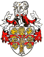
 Arms of Westmorland County Council | |
| ذیلی تقسیمات | |
| - قسم | Baronies, Wards (ancient) |
ویسٹمرلینڈ (انگریزی: Westmorland) برطانیہ کا ایک انگلستان کی تاریخی کاؤنٹیاں ہے۔[1]
مزید دیکھیے
حوالہ جات
- ↑ انگریزی ویکیپیڈیا کے مشارکین۔ "Westmorland"
|
|