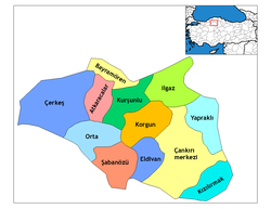
Orta, Çankırı
Orta | |
|---|---|
Town | |
 Location of Orta within Turkey. | |
| Coordinates: 40°37′N 33°06′E / 40.617°N 33.100°E | |
| Country | |
| Province | Çankırı |
| Government | |
| • Mayor | Bayram Yavuz Onay (AKP) |
| Area | |
| • District | 544.33 km2 (210.17 sq mi) |
| Population | |
| • Urban | Template:Turkey district populations |
| • District | Template:Turkey district populations |
| Time zone | UTC+2 (EET) |
| • Summer (DST) | UTC+3 (EEST) |
| Postal code | 18xxx |
| Area code | 0 |
| Licence plate | 18 |
| Website | www.orta.gov.tr |
Orta, formerly Kari Pazarı, is a town and district of Çankırı Province in the Central Anatolia region of Turkey.
See also
References
- ^ "Area of regions (including lakes), km²". Regional Statistics Database. Turkish Statistical Institute. 2002. Retrieved 2013-03-05.
Falling Rain Genomics, Inc. "Geographical information on Orta, Turkey". Retrieved 2008-03-13.
A company of Turkish soldiers, the number varying by corps. A jannissary orta in the time of Suleiman comprised 196 men.
External links
- District governor's official website (in Turkish)
- District municipality's official website (in Turkish)


